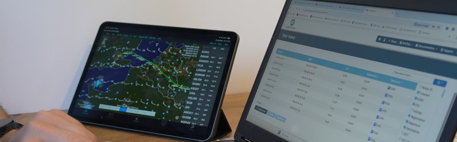
Introduction
The instrument rating training (fully described here) does not fully prepare you for outside the training regime; it merely scratches the surface of what is practically possible with the rating. The course is designed largely structurally; it’s baked into how the training system is designed.
In the UK/EASA environment, European airspace is generally more structured and restrictive than in the US, with a stronger reliance on controlled airspace, airway-based routing, published SIDs and STARs, and less flexibility in tactical rerouting, particularly outside radar coverage. As a result, instrument training tends to focus heavily on procedural compliance and fitting neatly into the system, rather than on how to use IFR strategically to your advantage. Pilots become proficient at flying within the network. Still, they are less often shown how to file intelligently to avoid inefficiencies, simplify complex airspace transitions, or use IFR proactively to improve reliability and reduce workload.
In Europe, the typical weather profile significantly shapes how the Instrument Rating is taught and perceived. Much of the year, especially in the UK, features low freezing levels, widespread stratiform cloud, and a persistent risk of airframe icing, while most GA training aircraft lack FIKI capability. As a result, instructors quite rightly emphasise conservative decision-making, icing avoidance, and cautious go/no-go calls. However, this can unintentionally frame IFR as something inherently hazardous and rarely usable, rather than as a strategic tool for improving dispatch reliability and safely operating through layered cloud. The focus on winter risk, while necessary, can overshadow how practical and powerful the rating can be in more favourable conditions, particularly in summer or when touring across Europe.
The Theory Emphasis & Training Limitations

The theoretical knowledge syllabus for the UK CAA/EASA Instrument Rating is extremely detailed and academically demanding, often pitched at a level close to airline standards. You study high-level meteorology, advanced air law, performance theory and systems depth that exceed what most private IFR pilots will practically use. While this builds strong foundational understanding, it does not always translate into real-world GA operational competence, such as single-pilot workload management, practical icing escape strategies in light aircraft, or efficient private touring across Europe. At the same time, most IR training is conducted in relatively basic aircraft; typically PA28s, C172’s, or DA40s, which operate without FIKI, turbocharging, or pressurisation. That environment naturally reinforces a conservative mindset centred on narrow weather margins, rather than demonstrating what becomes possible in more capable aircraft.
Compounding this, the broader EASA system has historically been designed with airline pathways in mind. Training emphasises procedural precision, SOP discipline, and structured CRM, which is ideal preparation for multi-crew commercial operations, but is less focused on the strategic thinking required for owner-flown IFR touring. After qualification, building meaningful IFR experience can also be slower and more expensive in Europe due to tighter airspace, higher costs, and frequent icing exposure, limiting opportunities for broad real-IMC experience. As a result, many pilots earn the rating fully procedurally competent, yet without a clear mental model of how powerful and efficient IFR flying across Europe can actually be once experience accumulates.
IFR flying as a single-pilot operation
Flying as a single-pilot operation under the Instrument Rating is designed to produce procedural precision, regulatory compliance, and strong theoretical knowledge within a highly structured airspace environment. It ensures you can safely control the aircraft and operate correctly within the system, but it does not necessarily teach you how to use IFR strategically for efficiency, dispatch reliability, or confident real-world touring in European conditions.
As a result, many newly qualified IR pilots initially see IFR as complex, restrictive, and primarily for deteriorating weather rather than as a powerful operational tool. Only with experience does the perspective shift, from “managing risk within tight margins” to understanding how IFR can be the most efficient and practical way to travel across Europe when applied with judgment and system knowledge.
My IFR flight planning guide is a strategy, rather than a how-to or a way of doing it, prepared. You are a sole pilot in one of the world’s most congested airspaces, and you have just a fraction of the performance of the other airspace users. With this strategic lens, IFR transforms. This isn’t about nailing the perfect NDB hold anymore. It’s about survival, dispatch reliability, and turning IFR from a regulatory cage into your secret weapon for confident, cross-continent touring.
What this guide will do
This guide walks through my real-world step-by-step process for planning an IFR flight in the UK and Europe, beyond training basics, from picking a destination to filing the plan.
- Assess feasibility first: select a destination matching aircraft range/performance, weather outlook, fuel requirements, customs/immigration availability, airfield hours, and PPR needs.
- Analyse weather thoroughly: review TAFs, METARs, SIGMETs, and winds aloft to choose practical altitudes and alternates, applying conservative (stricter-than-training) minima.
- Build the route: use Autorouter and Skydemon to create Eurocontrol-compliant airways plans, prioritising preferred directs, free route airspace, and NOTAM/airspace checks.
- Calculate fuel and performance: factor in actual winds, real aircraft burn rates, and extra reserves for contingencies.
- Finalise and file: enter aircraft details (equipment codes, PBN capabilities), validate the plan via IFPS-compatible tools, file electronically (e.g. AFPEx), and preload EFB charts for departure, en-route, and arrival.
This practical workflow keeps things efficient, compliant, and adaptable to the dynamic European IFR environment, far removed from rigid training exercises.
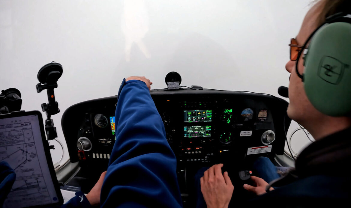
Disclaimer: This guide is not an instruction or official documentation. It’s purely a personal reference point, drawing on publicly available information and common practices. Always consult a qualified flight instructor, your aircraft’s documentation, current regulations (e.g. UK CAA, EASA, Eurocontrol), and official sources for guidance appropriate to your experience, aircraft, and intended flight. Do not rely on this guide for operational decisions.
Choosing a Destination Airport
When selecting a destination airport for single-pilot IFR flights, especially in Europe, prioritising big or well-equipped airports with excellent access to vibrant city centres or stunning beaches can transform a trip from a mere flight into a rewarding getaway. Larger airports like Amsterdam Schiphol (AMS) offer world-class IFR infrastructure, multiple precision approaches, reliable ATC vectors, and robust handling, making them manageable even solo in busy airspace. Schiphol stands out for its superb connectivity: a direct train whisks you to central Amsterdam in about 15-20 minutes, allowing quick immersion in canals, museums, and nightlife without long transfers. Similarly, airports serving major cities like Prague, Hamburg, or Luxembourg provide strong IFR options with straightforward approaches and good facilities, while public transport (trains, trams, or buses) often reaches historic centres in 20-40 minutes, ideal for short stays exploring architecture, culture, or events.
For beach-oriented escapes, focus on Mediterranean or coastal hubs that balance IFR accessibility with leisure appeal. Ibiza (IBZ) exemplifies this: its single airport handles IFR reliably with precision approaches, and it’s just 7 km (a short taxi or bus ride) from Ibiza Town and world-famous beaches, perfect for sun, sea, parties, or relaxed coastal vibes after a challenging cross-country flight. These choices leverage your IFR rating for weather resilience and direct routings, while the airport’s size ensures fuel, parking, and services without excessive single-pilot workload, pairing reliable flying with easy reach to urban energy or beach relaxation for memorable, low-stress adventures.
Here are 5 key considerations when choosing a destination airport for single-pilot IFR flights in Europe, focused on big/well-equipped fields with great access to city centres or beaches (drawing from real trips like Amsterdam Schiphol, Ibiza, Prague, Hamburg, and similar spots):
- Strong IFR infrastructure
- Quick, easy access to the city or the beach
- Manageable single-pilot workload
- Practical facilities on arrival
- Weather and alternate flexibility
I usually pick the destination because I actually want to go there. Ibiza because I’m craving sun, sea and that wild energy. Amsterdam Schiphol because I want to experience the business of a hub airport. The IFR planning, approaches and alternatives all come after, the trip starts with “I’d love to be there.” The technical side (weather briefing, fuel planning, IFR clearances, alternates, NOTAMs, performance calcs) is what makes it possible and safe, but it’s all in service of that initial “why.” Without the personal desire or curiosity driving the choice, most of us wouldn’t bother with the hassle of planning at all.
This is what makes private flying special; unlike airline ops where the route is dictated, we get to start with the destination we crave, then build the safe IFR path to get there. The planning is the puzzle; the destination is the prize.
EuroGA Database
The EuroGA Airport Database (airports.euroga.org) lets you search pilot-written reports on airports you’ve visited or hunt by map. It gives solid, real-world estimates of landing fees, parking, fuel prices, handling quirks, and the overall feel, often broken down roughly by aircraft type from actual visits. It’s all crowdsourced from EuroGA forum users, so the reports tend to be detailed, honest, and fairly up-to-date for planning trips.
If you have the SkyDemon app, this also has its own crowdsourced layer too: user-submitted fees, fuel costs, star ratings, facilities, and food notes. You can filter/highlight airfields by those categories right on the map and add your own feedback easily. SkyDemon’s info is handy and well-integrated (plates, routing, and weather all in one app), but it relies more on quick submissions and can feel a bit lighter on the detailed storytelling.

AIP Guidance
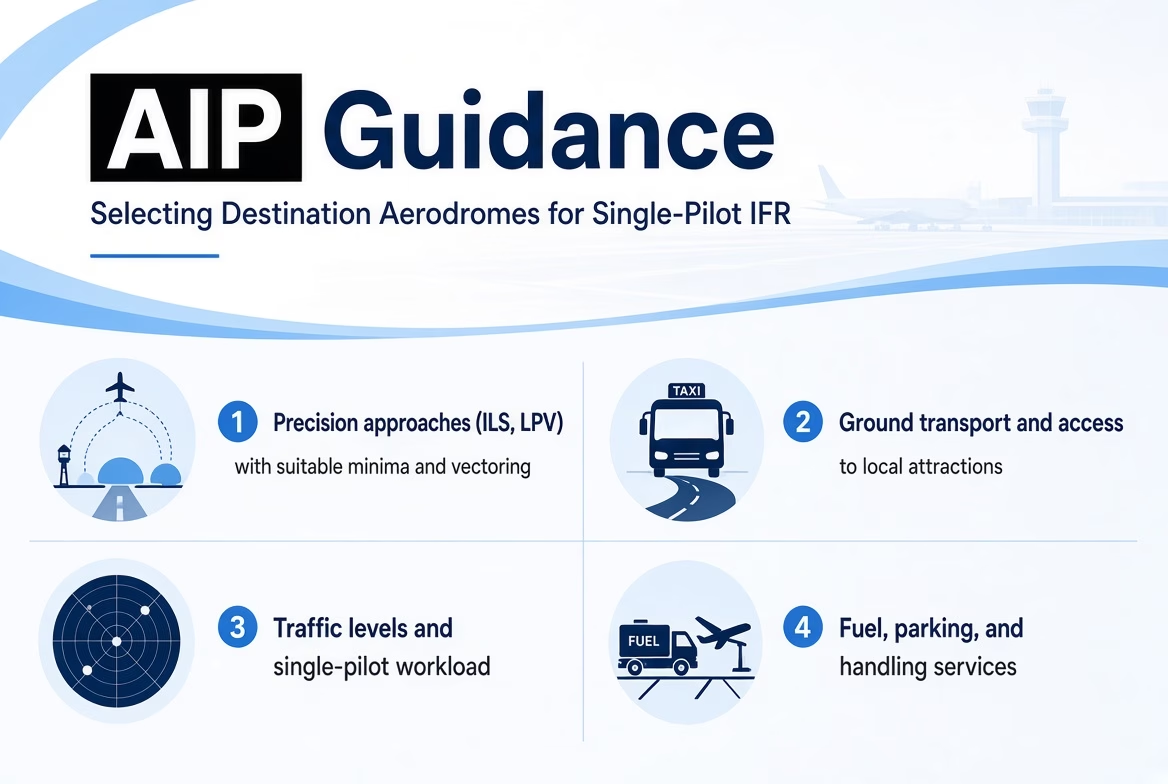
Here is practical guidance for single-pilot IFR pilots in Europe on selecting a destination airport, focused purely on what to check in the official Aeronautical Information Publication (AIP). This applies generally to any candidate aerodrome; avoid referencing specific examples. All key details are in the AIP (accessed via EAD Basic or national AIS sites). Always use the current effective AIRAC cycle and verify with the latest NOTAMs/amendments.
1. Precision approaches (ILS, LPV, etc.) with suitable minima and vectoring
- Go to the aerodrome’s AD 2 section.
- Check AD 2.12 (runway physical characteristics) for runway length, width, surface, and declared distances.
- Review AD 2.19 (radio navigation and landing aids) for available aids, frequencies, and identifiers (e.g., ILS, LPV, VOR).
- Study the instrument approach charts (typically in AD 2.24 or charts supplement): assess precision/non-precision types, DA/DH, visibility/RVR minima, glide path details, vectoring provisions, and missed approach procedures.
- Prioritise aerodromes with precision approaches offering low minima and radar vectoring for easier single-pilot handling in IMC.
2. Ground transport and access to local attractions
- In AD 2.20 (local aerodrome regulations) or AD 2.21 (noise abatement procedures), look for any remarks on public transport, taxi services, bus/train connections, or distances to nearby towns/resorts/coastline.
- Refer to AD 2.2 (aerodrome geographical and administrative data) for location coordinates, elevation, and proximity notes that help gauge access to urban areas or leisure spots.
- Remarks may mention transport options or facilities relevant to quick onward travel.
3. Traffic levels and single-pilot workload
- Check AD 2.17 (air traffic services and reporting points) for approach control details, frequencies, and services.
- Review AD 2.18 (ATS airspace) for control zone (CTR)/terminal control area (TMA) boundaries, classes, and limits.
- In AD 2.22 (flight procedures), note SIDs/STARs complexity, mandatory handling/PPR, slot requirements, or traffic density indications.
- Cross-reference nearby ENR sections for airspace structure and route, favour aerodromes with straightforward procedures and manageable vectoring/radio workload for solo operations.
4. Fuel, parking, and handling services
- AD 2.4 (handling services and facilities) details handling agents, whether mandatory (common at larger aerodromes), contacts, and GA provisions.
- AD 2.6 (rescue and fire fighting services) and AD 2.7 (seasonal availability) cover fuel grades (e.g., Jet A-1, 100LL), availability hours, parking areas/fees, and hangar options.
- Look for notes on GA aprons, self-service fuel, or dedicated handling to ensure smooth arrival and turnaround.
5. Meteorological information and alternate suitability
- AD 2.11 (meteorological information provided) lists ATIS frequency, automated weather systems (AWOS/ASOS), observation schedules, and forecast details.
- For alternates, consult national ENR 1.3 (or equivalent) for designated lists, then examine candidate aerodromes’ AD 2 for comparable approaches, fuel, and meteo services.
- Prefer alternates separated by 50+ NM for weather diversity; remarks may indicate local phenomena (e.g., fog risk) affecting reliability.
Accessing the AIP
- Main source: EAD Basic (https://www.ead.eurocontrol.int/) – register for free access to the AIP Library (eAIPs by country, including charts and AD/ENR sections). Note: intended for reference; confirm operational use with official channels.
- Alternative: National AIS websites (listed via EUROCONTROL AIS Online at https://www.eurocontrol.int/articles/ais-online, by state) – many provide free public eAIP PDFs or online viewers.
- Pull the effective version early in planning, apply AIRAC updates, and integrate NOTAMs to confirm suitability for your aircraft, IFR capability, and trip objectives.
This checklist draws directly from standard AIP structure (per ICAO Annex 15 and Doc 8126 guidance) and use it systematically for any potential destination to ensure safe, efficient single-pilot IFR operations.
EuroGA Database
I use the EuroGA Airports Database (at https://airports.euroga.org/search.php) to speed up pre-planning by quickly filtering potential destination airports based on key GA-friendly criteria, like ICAO code, country, runway details, maximum landing fees, fuel availability, customs/immigration, handling, or keywords often with direct links to the relevant official AIP sections or charts where available, letting me narrow down suitable options and jump to authoritative AIP data faster than browsing full national eAIPs from scratch.
PPR/PNR & Customs
For single-pilot general aviation (GA) flights from the UK to continental Europe (Schengen Area) as of March 2026, arrivals from the UK require customs and immigration clearance at the first Schengen entry point. PPR (Prior Permission Required) and PNR (Prior Notice Required/Prior Notification Required/Customs O/R) are longstanding requirements in European GA, particularly for customs-capable or restricted airfields, and predate recent border changes.PPR and PNR explained
- PPR requires explicit prior permission from the airport authority, handling agent, or local officials before landing. It’s often needed for limited hours, parking constraints, noise rules, mandatory handling, or customs/immigration coordination at many regional or smaller GA fields.
- PNR (or “Customs O/R”) is advance notification specifically for customs/immigration services when arriving from a non-Schengen country like the UK; you provide aircraft details, crew/passenger manifests, ETA, and General Declaration (GenDec), typically via email, phone, or handler, with confirmation that border officials will be available.
These are listed in the destination airport’s AIP AD 2 section (local regulations, remarks, handling, or customs notes) via EAD or national sites. Many customs airports mandate PNR/PPR for inbound international GA to arrange officer attendance, even if they don’t always meet the aircraft.
Customs and immigration for arrivals from the UK
- Land at a designated customs/immigration airport (with on-site or callable services) for your first Schengen entry, not every GA airfield qualifies. Check national AIPs (e.g., AD 1.3 or GEN sections for international traffic permissions and customs lists) or GA resources like EuroGA for current lists.
- Submit GenDec and crew/passenger details in advance per airport rules; officials handle passport checks, entry stamps (phased out as systems evolve), and declarations (e.g., Temporary Admission for non-EU aircraft).
- After clearance at the first point, intra-Schengen flights are generally free of routine border checks.
- Current EU border systems (March 2026): The Entry/Exit System (EES) is in progressive rollout (started October 2025, full deployment targeted April 2026, with some flexibilities for peaks); non-EU nationals (including UK citizens) provide biometrics (fingerprints + photo) on first arrival at dedicated kiosks/booths, potentially adding time during busy periods. No pre-submission required.
- ETIAS (European Travel Information and Authorisation System) is not yet operational (expected last quarter/late 2026); no action needed now for visa-exempt short stays.
Practical planning tips
- Verify PPR/PNR/customs status in the AIP (AD 2 remarks) + current NOTAMs, as hours and availability vary.
- Use a ground handler at larger/regional fields (often mandatory) to manage notifications, slots, fuel, parking, and customs coordination.
- File flight plans early and include relevant remarks.
- For UK returns: Submit GAR (General Aviation Report) online with crew/passenger details (required for international flights).

Flight from EASA land to the UK
For pilots in general aviation flying from Europe (EU/EASA countries) into the UK as of March 2026, the main requirements focus on immigration/border entry, flight notification, and pilot/aircraft licensing/operations. Post-Brexit, the UK treats European pilots and aircraft as third-country, but GA flights remain straightforward with proper prep.
Immigration and Travel Permission (Key Change in 2026):
EU nationals (and other visa-exempt visitors) need a valid Electronic Travel Authorisation (ETA) to enter the UK for visits up to 6 months. Full enforcement started on 25 February 2026. Apply online via the UK government site. it’s £16, valid for 2 years or until passport expiry. However, operating aircrew (the pilot in command and essential crew) on GA flights are exempt from the ETA requirement under the Immigration Act 1971, as long as they’re operating in and out within 7 days. Passengers still need their ETA (or visa if applicable), and the PIC must confirm this when submitting the flight report. Fines are steep if you get it wrong, so double-check everyone onboard.
Flight Notification – General Aviation Report (GAR) :
You must submit a GAR online in advance for all international GA arrivals/departures (including from EU countries). This notifies Border Force and HMRC about the flight details, persons onboard, ETA/ETD, and customs info.
- Submit via the online portal (gov.uk) at least 4 hours before arrival for most flights.
- Include details like aircraft registration, pilot info, passenger list, and confirm valid permissions (e.g., ETA for pax).
- Use approved customs/immigration airports (many GA airfields are designated; check the list on gov.uk or in the AIP). Direct to non-approved fields may need prior permission.
- The PIC is responsible. screw-ups can lead to big penalties.
Always cross-check official sources (national AIPs, EuroGA forums, or aviation authorities) for the latest, as procedures can change.
Key Forms & Websites
Here are some of the key forms and websites I’ve used or found helpful for handling General Declarations (GenDec), SGAR, and related customs/immigration notifications on GA flights from the UK to Europe (and returns):
- UK SGAR (Submit General Aviation Report) – For all international arrivals and departures to/from the UK (including crew/passenger details and advance submission requirements). Use the official GOV.UK digital service at https://www.submit-general-aviation-report.service.gov.uk/ – submit no earlier than 48 hours and no later than 2 hours before departure.
- ICAO General Declaration (GenDec) form – Standard template for outward/inward declarations (per ICAO Annex 9, Appendix 1), useful as a base for many European customs/immigration submissions. Download the official blank form here: https://www.icao.int/sites/default/files/FAL/AircraftGeneral-Declaration-Appendix-1-to-ICAO-Annex-9-1.pdf (or similar versions from aviation sites – this is the one I use.)
- GENDEC EU for the Netherlands/ Electronic platform to create and submit GenDec to the Royal Netherlands Marechaussee for flights crossing Schengen external borders (inbound/outbound from non-Schengen countries like the UK). Submit at least 2 hours before departure via https://www.gendec.eu/ – user-friendly, with stored aircraft/crew details.
- Belgium General Declaration website – Online platform for submitting GenDec to Belgian air border guards (Federal Police) for flights entering/leaving the Schengen area. Access the digital form at https://digital.belgium.be/iaf/hil/police/gendec/ (via police.be/bordercontrol).
- Luxembourg Police aviation site – Airport Police Unit (UPA) handles border control and coordinates with customs at Luxembourg Findel (ELLX); general info on police presence, immigration checks, and aviation security at https://police.public.lu/en/votre-police/services-et-unites/upa.html – contact for specific GA customs queries.
Always verify current requirements directly on these sites or in the relevant national AIP (AD 2 remarks/customs sections), as procedures can vary by airport, time, or updates. Cross-check with NOTAMs and handlers for your specific flight.
Additional tips for GA/single-pilot use in Europe:
- For short private flights, keep the crew manifest simple (just PIC); passenger manifest with full details (surname, given names, birth date/place, passport country/code/number). Ensure passports match exactly.
- If no health/disinsection issues (typical), use “None” to keep it clean.
- Attach extra sheets if more pax/crew than fits.
- For countries like the Netherlands (gendec.eu), Belgium (digital portal), or others, enter data online first, it often generates/submits the form electronically, reducing paper need.
- Switzerland/Germany may require their own forms (e.g., Form 11.33), or instead submit GenDec as the base.
- Always carry copies (pilot + officials); file flight plan with relevant remarks if needed.
- Verify with current AIP/NOTAMs/handler – requirements vary by airport/country (e.g., some accept digital only).
This ensures compliance for safe, smooth border crossings. If using your Word template, save versions per flight for reuse.

IFR SLOTS
In Europe (EASA states and associated countries), IFR flight planning often involves dealing with two distinct types of slots: airport slots and CFMU slots (now more commonly called ATFCM slots or CTOTs from EUROCONTROL’s Network Manager, formerly the Central Flow Management Unit or CFMU).
To be clear, the only slot you need to apply for in advance is the airport slot (via the ground handler or directly to the slot coordinator, details found in the airport’s AIP AD 2 section), while the CFMU/CTOT slot (ATFCM measure from EUROCONTROL) is automatically assigned after filing your IFR flight plan and requires no application.
Airport slots
These are permissions granted by an independent national slot coordinator to use the airport’s infrastructure (runway, gates, apron, etc.) at a specific date and time for take-off or landing. They are required at coordinated (Level 3) airports where demand exceeds capacity (e.g., major hubs or busy regional fields during peak seasons). Under EU Regulation 95/93, slots are allocated fairly, transparently, and non-discriminantly, often with an 80/20 “use-it-or-lose-it” rule for series. For GA, you typically request them in advance via a GCR (General Aviation Clearance Request) message, and many airports mandate using a ground handler to submit it. Once allocated, include the slot reference in your flight plan (Field 18). Missing or significantly off-slot can lead to denial of service or penalties.
Departure SLOTS
For departure purposes in Europe (and globally under IATA Worldwide Airport Slot Guidelines), an airport slot is allocated based on the planned off-block time (also called Scheduled Off-Block Time or SOBT), which is the time the aircraft is scheduled to push back from its parking position or gate, start taxiing, or depart the stand, not the actual runway take-off time. This is because the slot grants permission to use the full range of airport infrastructure (stand, apron, taxiways, runway sequencing) for the overall departure operation, and the coordinator bases the allocation on the expected off-block to manage ground capacity, turnaround, and flow efficiently. Actual take-off can vary due to taxi time, queuing, or other factors, but the slot reference ties to that planned off-block moment (with typical tolerances like ±15 minutes or airport-specific rules for compliance).
Arrival SLOTS
For arrival purposes at coordinated airports in Europe (and globally under IATA Worldwide Airport Slot Guidelines), an airport slot is allocated based on the planned on-block time (also called Scheduled In-Block Time or SIBT), which is the time the aircraft is scheduled to arrive at its parking stand or gate and shut down engines, not the actual touchdown or runway arrival time.
The Caveat in the SLOT Application
I find that submitting an airport slot request via a ground handler is usually the easiest and most reliable method for my single-pilot GA IFR flights in Europe, since they format the GCR correctly, coordinate with the slot coordinator, and take care of parking, fuel, and customs in one go, though it does come with an admin or handling fee (typically €50–€200+). The GCR format itself is straightforward once you get the hang of it (plain text with header, action lines, UTC times, and SI/GI notes), but I’ve learned that contacting coordinators directly can sometimes lead to inconsistent or unhelpful responses, so I usually prefer routing everything through the handler unless the AIP explicitly allows direct submission.
In Spain, especially when I’m trying to keep costs low like in my “El Cheapo” approach, going manual lets me avoid those expensive handler packages at places like Ibiza by dealing directly with a minimal ramp agent (e.g., Ground Force for the minibus transfers) and submitting the GCR myself, often bringing the total cost down by hundreds of Euros.
Coordination
The most comprehensive and up-to-date source for airport slot coordination contacts across Europe (including Level 3 coordinated airports and Level 2 facilitated ones) is the IATA Worldwide Airport Slot Guidelines (WASG) Annex 12.7, which lists coordinator emails, websites, and online portals globally (with a strong focus on Europe).
Download the latest Excel file directly from IATA here: https://www.iata.org/contentassets/4ede2aabfcc14a55919e468054d714fe/wasg-annex-12.7.xlsx (updated periodically; check the main WASG page at https://www.iata.org/en/programs/ops-infra/slots/slot-guidelines for the current edition as of March 2026).
This annex includes:
- Coordinator names, emails (e.g., for SCR/GCR submissions), and sometimes telex/portal links per airport or country.
- Coverage for major European coordinators, like:
- Germany (Fluko): Various emails (e.g., fraztxh@fluko.org for Frankfurt-related).
- UK (ACL): lonacxh@acl-uk.org, website www.acl-uk.org.
- Spain (AECFA): slots@aecfa.es, website https://www.slotcoordination.es/
- Nordic countries (Nordic Airport Coordination): scr.se@airportcoordination.com, website airportcoordination.com.
- Cyprus: cyprus-slots@dca.mcw.gov.cy (SSIM messages), ocs@dca.mcw.gov.cy (OCS inquiries), website www.slots-cyprus.eu.
- Austria (Slots Coordination Austria): slot.gac@viennaairport.com or similar for GA, website slots-austria.com.
- France (COHOR): Details on cohor.org.
- Italy (e.g., ASSOCLEARANCE): slot@assoclearance.it.
- Bulgaria (Sofia): Via sofia-airport.eu or similar.
Additional key resources:
- European Airport Coordinators Association (EUACA): Main site at https://www.euaca.org/ – lists member coordinators and links to national entities (though not always direct emails).
- National AIPs (via EUROCONTROL EAD Basic) often reference the coordinator in AD 2 remarks for specific airports.
For GA-specific requests (e.g., GCR format), many coordinators prefer or require submission via handlers, but the WASG Annex 12.7 Excel is the single best centralised list of emails and websites. Always verify the current version on IATA’s site, as contacts can change seasonally.
GCR (General Aviation Clearance Request)
The GCR is a standardised, machine-readable message format (based on IATA SSIM Appendix K) used specifically for General Aviation (including business aviation and private flights) to request airport slots. It uses ICAO codes (4-letter airport codes, ICAO aircraft types) and is sent in plain text via email or sometimes through online portals/handlers.
Several practical guides and resources are available online for submitting GCR (General Aviation Clearance Request) messages for airport slots in Europe, particularly useful for single-pilot GA/IFR pilots. These cover format details, examples, and submission tips (often from coordinators, software providers, or aviation communities).
- Autorouter. aero Wiki on GCR – Detailed explanation of how GCRs work for GA, including automated generation/submission in their tool, response handling, and inserting confirmed slots into flight plans: https://www.autorouter.aero/wiki/gcr
- Nordic Airport Coordination Guide (PDF) – Comprehensive guide to GA/BA slot requests using GCR format, with examples for Nordic countries (Denmark, Estonia, Finland, etc.), action codes, and email submission: https://airportcoordination.com/wp-content/uploads/2024/08/slot-request-gcr.pdf
- Fluko (Germany) GCR Guidelines (PDF) – Official explanations and examples for German coordinated airports (e.g., EDDF), including header, data lines, footnotes, and common formats for arrivals/departures: https://fluko.org/wp-content/uploads/2018/08/GCR-INT.pdf
- Universal Weather Blog on Understanding GCR – Overview article with tips on GCR usage, where it’s applied (e.g., Germany, Dubai), differences from SCR, and practical advice: https://www.universalweather.com/blog/understanding-general-aviation-clearance-request-gcr-airport-slots
- ACNL (Netherlands) General Aviation page – References IATA SSIM Appendix K for GCR instructions and examples, with notes on their process: https://slotcoordination.nl/general-aviation
- Airport Bratislava (BTS) GCR Manual (PDF) – Detailed manual with principles, examples for arrival/departure lines, action codes, and flows (new/change/delete): https://www.bts.aero/content/slot_coordination/gcr_manual_bts.pdf
Many coordinators (e.g., for Czechia, Greece, Portugal) publish similar PDF manuals on their sites or in AIP references. For country-specific airports, search the coordinator’s website (from IATA WASG Annex 12.7) or check AIP AD 2 remarks. Tools like Autorouter automate much of this for GA pilots, reducing manual formatting errors. Always use the latest IATA SSIM Appendix K as the standard reference (available via IATA resources or coordinator links).
The NOP (Network Operations Portal)
The NOP (Network Operations Portal) is the main online platform from EUROCONTROL’s Network Manager (NM), specifically the Network Manager Operations Centre (NMOC), that gives pilots, airlines, ANSPs, airports, and other aviation stakeholders real-time and collaborative access to European network info. It provides:
- Live traffic situation monitoring
- Air Traffic Flow and Capacity Management (ATFCM) status, including regulations, delays, slots (CTOTs), and measures
- Airspace status, NOTAMs, route availability (via RAD – Route Availability Document)
- Flight plan validation tools, NOP (Network Operations Plan) outlooks, and more
- Public version (freely accessible at public.nm.eurocontrol.int) for basic views; protected/logged-in version for detailed ops and interactions.
In short, if you’re flight planning in Europe (especially IFR cross-border), the NOP is where you check for current restrictions, expected delays, or submit coordination requests, replacing what old-timers still call “CFMU slots”. Many GA pilots use the public NOP for a quick network overview before filing.
Further down, there is more on how you can apply for Protected Access.
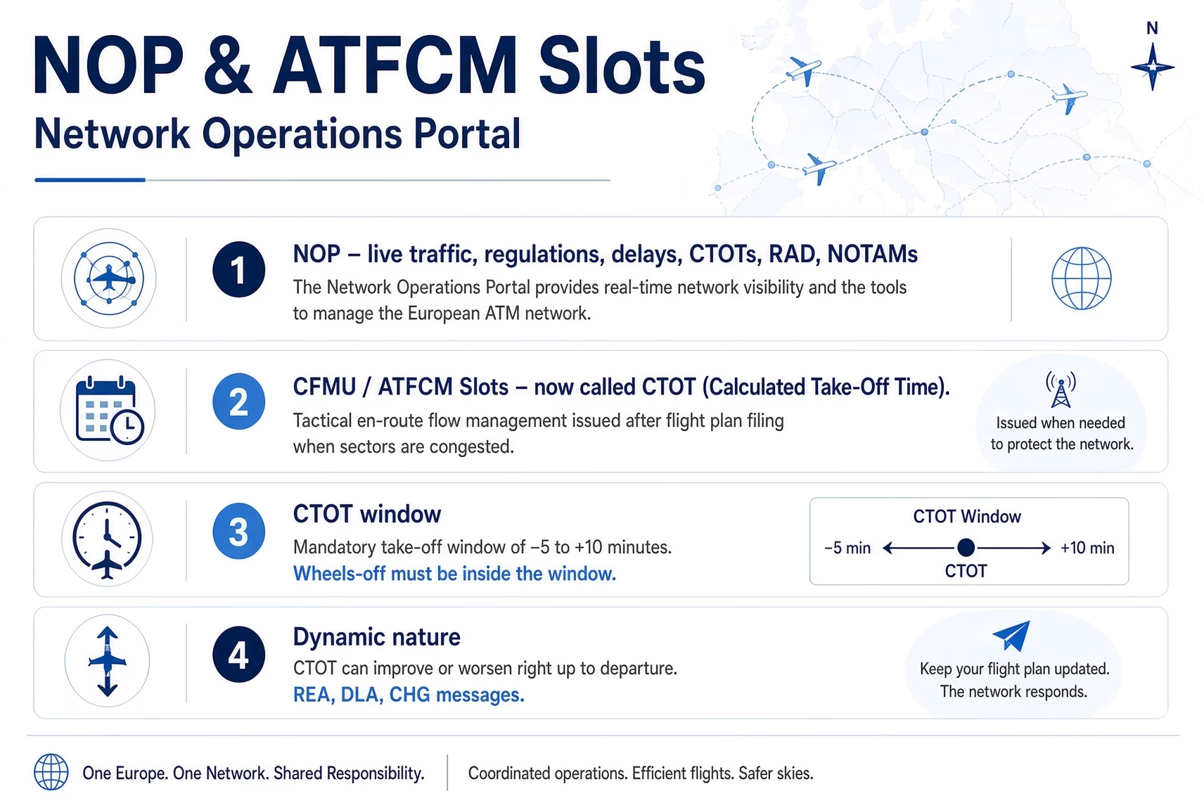
CFMU slots/ATFCM slots/CTOT (Calculated Take-Off Time)
CFMU slots (the old name for what is now officially called ATFCM slots or CTOT, Calculated Take-Off Time) are tactical en-route flow management measures issued automatically by EUROCONTROL’s Network Manager after you file your IFR flight plan, whenever airspace sectors are congested.
Unlike airport slots (which protect ground/apron/runway capacity at coordinated airports and are based on your planned off-block or on-block time), a CTOT is a mandatory take-off window with a fixed tolerance of -5 minutes to +10 minutes around the assigned time. You must depart (wheels off the runway) within that exact window, or you risk startup denial, suspension of the flight plan, or penalties.
How CTOT varies
CTOT is dynamic and can change multiple times right up to departure:
- It often improves (moves earlier) within minutes if traffic eases or you send fresh data (e.g., updated TOBT via REA message or DLA/CHG).
- It can also worsen if new restrictions appear.
- If a new CTOT looks bad, wait 10 minutes; the system frequently settles to a better time automatically.
- You monitor updates via your flight-planning software (Autorouter, etc.), handler, or NMOC messages; you can request improvements or short extensions through your handler, NMP Flow, or the e-Helpdesk in many cases.
How CTOT overrides the airport slot
The CTOT always takes priority over your airport slot for the actual departure.
The airport slot guarantees you a stand and ground access at your planned off-block time, but once a CTOT is issued, you must adjust your push-back and take-off to meet the CTOT window, even if it means departing earlier or later than your original airport slot allowed. In practice, this means:
- If the CTOT is much later, you may need to re-coordinate the airport slot (via handler or direct GCR).
- If the CTOT is earlier, you push earlier (provided you’re ready and the airport slot tolerance allows it).
- For single-pilot GA, this is why most pilots file the flight plan after securing the airport slot (so the initial EOBT matches the airport slot), then let EUROCONTROL overlay the CTOT and handle any resulting mismatch through the handler or software.
In short: airport slot = ground permission; CTOT = the binding take-off time you actually have to hit. Always comply with the CTOT first, it protects the entire European network. Check your AIP AD 2 or use tools like Autorouter for real-time monitoring.
Autorouter
Autorouter. aero is a cloud-based flight planning and filing tool specifically designed for European general aviation (GA) pilots, including single-pilot IFR operations, and it’s widely regarded as one of the best options for light aircraft flying in the Eurocontrol region.
You start by signing up for a free account, entering your aircraft details (registration, type, performance data like climb/descent rates, cruise speed, and fuel burn), and then simply input your departure and arrival airports (ICAO codes), along with any preferences like max altitude, wind data, or route tweaks. The system uses a powerful routing engine to generate the shortest valid IFR routes in seconds, often better than manual planning, while automatically validating them against Eurocontrol’s rules (e.g., airways, SIDs/STARs, airspace restrictions, and NOTAMs). It produces a complete flight plan profile with levels, fuel estimates, times, and even graphical path views.
Reducing Workload
For IFR, autorouter excels by handling complex European airspace: it files the plan directly to Eurocontrol’s IFPS (Integrated Initial Flight Plan Processing System) in ICAO format, supports GCR (General Aviation Clearance Request) for airport slots at coordinated fields (showing you the message to copy/send to the coordinator or via handler), and monitors for CTOT (Calculated Take-Off Time) issuances, sending alerts via email/SMS/Telegram chatbot when a CTOT comes in or changes. You can amend delays, cancellations, or updates through the same chatbot, get instant briefing packs (NOTAMs, weather, charts), and even handle hybrid VFR/IFR segments (as long as there’s an IFR part in Eurocontrol airspace).
Overall, for single-pilot IFR in Europe, Autorouter reduces workload dramatically, from route finding and slot coordination to filing, monitoring, and briefings, all in one place, making cross-border trips (like UK to Schengen) far more manageable and efficient than traditional methods or other tools. It’s especially popular in the GA community for its speed, accuracy, and free tier features.
Managing Delays
Autorouter.aero also gives you powerful control over your IFR route to help avoid or mitigate ATFCM delays (CTOTs) by allowing you to self-reroute on the fly. If a CTOT comes back much later than expected, you can quickly edit the route in the interface, inserting specific waypoints, airways, or even direct segments, to force the flight plan through less congested sectors or avoid known bottlenecks. Once you save the change, Autorouter automatically re-files an amended flight plan (via CHG or CNL/NEW messages) to Eurocontrol’s IFPS, which recalculates the CTOT based on the new routing.
In many cases, this results in an earlier or more favourable CTOT, or even removes the restriction entirely if the new path bypasses the overloaded airspace. You can experiment with multiple route options in the planner before filing, preview the estimated fuel/time impact, and monitor for updated CTOTs via email/SMS/Telegram alerts, all of which make it especially useful for single-pilot IFR when you want to keep moving without waiting hours for the original route to clear.
Real World Example
The example I mentioned earlier of Autorouter’s self-rerouting in action comes from my return flight from Basel-Mulhouse (LFSB) to Oxford Kidlington (EGTK) as described in my trip report “A quick 24 hours“. After a smooth outbound leg the previous day (delayed a full 15 hours by persistent bad weather with showers, troughs, and thunderstorm risks across the route), the return was hit by a ~90-minute slot delay due to ATC shortages in the London sectors (affecting Biggin Hill and Stapleford areas) plus Paris TMA complexities and lingering restrictions from events like the Olympics.
Rather than sit on the ground or risk a VFR slog, I used Autorouter to quickly experiment with alternative routes: I forced the plan via a western path around Paris (inserting waypoints like RLP, LGL, MID & CPT) to avoid the congested eastern sectors.
Autorouter validated the new routing for Eurocontrol compliance, estimated the fuel/time impact (adding some distance but saving time overall with better winds), and let me re-file the amended flight plan (via CHG message). Within minutes, the recalculation cleared a much more favourable CTOT (or removed the heavy restriction entirely) by shifting away from the overloaded airspace, allowing departure closer to my planned time (1530Z) instead of waiting hours. The flight ended up around 4.5 hours with headwinds and some IMC climb-out, but the reroute made it feasible and enjoyable, landing at EGTK just after sunset for a scenic NDB approach. It’s exactly why Autorouter is invaluable for single-pilot IFR: quick what-if reroutes, instant re-filing, and real-time CTOT monitoring via alerts, turning potential ground holds into productive airborne time.
Tactical Planning
In terms of route-planning, it may be necessary to have alternative routes based on severe weather identified in the IFR Weather Planning Section, allowing greater flexibility as per the real-world example above, but also to avoid significant weather, potentially solid IMC for hours on end, to not scare your passengers or to avoid convective rainfall systems in addition to airspace heavily slot-controlled. This framework ensures dispatch reliability.
Occasionally, Autorouter will suggest alternative routes. Note these down, but also force the routes to ensure greater flexibility to meet your airport slot.
A more detailed write-up on tactical planning for Autorouter.aero will come soon.

SkyDemon
SkyDemon is a popular flight planning and navigation app primarily built for European VFR pilots, but it includes useful IFR features that make it a solid companion for single-pilot instrument-rated GA flying in the region. Available on iOS, Android, PC, and iPad, it runs on a subscription model (with a free 30-day trial) and focuses on clear, uncluttered vector charts, dynamic airspace depiction, and easy route creation by tapping waypoints on the map. For IFR, enable “Show IFR Features” in the Planning Options menu to access Airways Mode (which strips out VFR airspace clutter and focuses on airways, fixes, and enroute structures), georeferenced instrument approach charts overlaid on the map, and IFR-specific NOTAM briefings.
Planning in SkyDemon is intuitive: create a route visually or via keyboard, adjust altitudes/speeds, set alternates, and get automatic calculations for fuel burn, minimum safe altitudes (MSA) per leg, headings, climb/descent profiles, and enroute hazards via the Virtual Radar side-view window (showing terrain, obstacles, airspace, and winds aloft). It pulls in METAR/TAF bulletins, weather overlays (personalised for your minima), and NOTAMs with visual hazard markers on the chart.
While it doesn’t handle full Eurocontrol route validation/filing like Autorouter, many pilots pair the two, generate/validate/file the IFR plan in Autorouter, then export the route to SkyDemon for detailed charting, briefings, and in-flight moving map use.
In-flight, SkyDemon shines with GPS navigation, real-time hazard warnings (airspace infringements, temporary restrictions, traffic via compatible devices), quick diversions, and features like querying frequencies or airspace status by tapping the map. It’s not a full IFR powerhouse (no native IFR flight plan filing or advanced synthetic vision), but for European light GA IFR, especially when combined with tools for routing, its simplicity, accurate charts, and strong VFR/IFR hybrid support make it a favourite for relaxed, safe flying.
I use SkyDemon primarily for in-flight monitoring of ADS-B traffic, maintaining general situational awareness, and cross-checking estimated headings and track against the route I get from Autorouter, all while layering in Golze in-flight weather data for real-time updates.SkyDemon connects seamlessly to ADS-B receivers (via WiFi or GDL90 protocol from devices like SkyEcho, PilotAware, or others), displaying traffic directly on the moving map and in a dedicated traffic instrument with proximity warnings and collision alerts when aircraft get too close.
This gives me excellent visual and audible situational awareness of nearby aircraft, especially useful in busy European airspace or when descending through layers, showing positions, altitudes (corrected where possible), callsigns, and relative motion, so I can spot and avoid conflicts without relying solely on ATC calls or looking out the window constantly in IMC.
For route guidance, I import my Autorouter-planned IFR flight plan into SkyDemon (exported as a .flightplan file from Autorouter’s briefing pack or route details), which overlays the magenta route line, waypoints, airways, estimated headings (adjusted for wind), and climb/descent profiles on the map. This lets me monitor if my actual ground track and heading match the planned ones, with quick visual cues for any deviations due to vectors, wind changes, or reroutes, essential for single-pilot ops to stay on top of the plan without head-down fiddling.
SkyEcho lets me send the route to the Golze app (ADLConnect) so the flight plan can be viewed and used there for in-flight weather overlay. At the same time, I integrate Golze in-flight weather into SkyDemon, which overlays radar returns, lightning strikes, satellite imagery, and METAR/TAF updates on the same moving map. The weather refreshes every 15 minutes via satellite, giving me dynamic views of approaching fronts, CB cells, or icing layers en route, perfect for making timely decisions like deviations or holding patterns. Combined with SkyDemon’s own METAR/TAF bulletins and hazard markers, this setup provides a layered, low-workload picture of traffic, weather, and navigation, making European IFR flights safer and more predictable in marginal or changing conditions.
Whilst SkyDemon isn’t a certified IFR tool (it’s primarily designed for VFR with optional IFR features like airways mode and georeferenced approach plates), I’ve used it safely for years as a powerful situational awareness aid during my single-pilot IFR flights, especially when transitioning in and out of controlled airspace around Stapleford Aerodrome (EGTA).
Stapleford sits in Class G uncontrolled airspace, but it’s surrounded by busy London TMA/CTR zones (Class D) and nearby Class A airways, so departing or arriving often involves careful navigation near the edges of controlled airspace, potential FIS from Stapleford Radio, or handoffs to London Info/Approach. SkyDemon’s moving map keeps the airspace boundaries clearly visible (with colour coding for classes and activity hours), shows real-time GPS position, terrain/obstacles, and dynamic hazard warnings, if I stray too close to CAS or a NOTAMed area, it alerts me visually and audibly, giving me extra margin to stay clear or request clearance if needed.
Combined with ADS-B traffic from my SkyEcho (displayed on the map with proximity warnings), the imported Autorouter route (magenta line with estimated headings and climb/descent profiles), and Golze satellite weather overlays (radar, lightning, imagery refreshed every 15 minutes), it creates a layered, low-workload cockpit view.
When leaving Stapleford on an IFR departure (e.g., climbing out toward a SID or direct to an airway join), I can monitor if my track matches the plan, spot nearby traffic in the busy GA corridor, and watch for weather cells building nearby, all without head-down time on paper charts or basic instruments. It’s not primary navigation for IFR, but as a backup and awareness tool, it has proven reliable and confidence-building for those critical transitions in and out of controlled airspace.
Enroute Alternates (RALT)
En-route Alternates (RALT), also known as en-route alternate aerodromes, are airports designated along your IFR route where you could divert if a problem arises during the cruise phase (e.g., medical emergency, mechanical issue, or worsening weather) requiring an immediate landing.
Under ICAO standards (Annex 6 and Doc 4444), an en-route alternate is primarily required for Extended Diversion Time Operations (EDTO/ETOPS) on twin-engine turbine aircraft when the route exceeds standard diversion times (e.g., beyond 60/120/180 minutes from a suitable airport, depending on certification). For non-EDTO flights, including most light GA single-pilot IFR in Europe, an RALT is not mandatory at the planning stage unless you’re using it to reduce contingency fuel (e.g., from 5% to 3% under EASA/ICAO rules for certain ops, where weather at the ERA must meet specific planning minima ±1 hour of ETA).In Europe (EASA-regulated or ICAO-compliant ops):
- RALT is listed in the flight plan’s Item 18 as RALT/ followed by ICAO codes (e.g., RALT/EGLL EINN) if required or chosen.
- It’s distinct from destination alternates (mandatory unless VMC certainty + separate runways at destination) and take-off alternates (for poor departure weather).
- For single-pilot GA IFR, many pilots nominate practical en-route alternates anyway (e.g., 50+ NM from route, good approaches, fuel availability) for safety margin, especially on long cross-country legs with limited options, even if not filed, they’re part of personal planning.
Practical tips for GA:
- Choose ones with precision approaches, reliable weather reporting, fuel, and handling; avoid those with complex procedures solo.
- Tools like Autorouter or SkyDemon help identify candidates along your route with quick checks.
- Always verify suitability in AIP AD 2 (facilities, minima) and current NOTAMs/weather.
For most European single-pilot IFR trips (non-EDTO), focus on a solid destination alternate and personal en-route options rather than strict RALT filing.
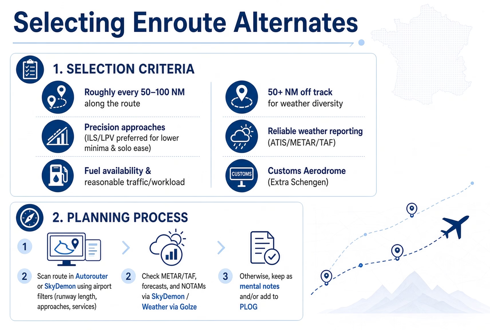
For my single-pilot IFR flights in Europe, planning en-route alternates (RALT) is mostly about building personal safety margins rather than strict legal requirements, since true RALT mandates mainly apply to EDTO/ETOPS ops on turbine twins or specific fuel-reduction cases (e.g., dropping contingency fuel from 5% to 3% under EASA/ICAO rules, where the ERA must meet planning minima ±1 hour of ETA).
In practice, I treat enroute alternates as “crash alternates” or diversion points for emergencies like medical issues, engine trouble, or sudden weather/icing deterioration mid-cruise. I aim for airports roughly every 50–100 NM along the route (or within gliding range for singles), ideally 50+ NM from the main track for weather diversity, with good facilities: precision approaches (ILS/LPV preferred for lower minima and single-pilot ease), reliable weather reporting (ATIS/AWOS), fuel availability, and reasonable traffic/workload.
Selection criteria:
- Roughly every 50–100 NM along the route
- 50+ NM off track for weather diversity
- Precision approaches (ILS/LPV preferred for lower minima & solo ease)
- Reliable weather reporting (ATIS/METAR/TAF)
- Fuel availability & reasonable traffic/workload
- Customs Aerodrome (Extra Schengen)
Planning process:
- Scan route in Autorouter or SkyDemon using airport filters (runway length, approaches, services)
- Check METAR/TAF, forecasts, and NOTAMs via SkyDemon/ Weather via Golze
- Otherwise, keep as mental notes and/or add to PLOG
En route updates: Reassess live options based on position, weather changes, and fuel; use SkyDemon map + Golze overlays for quick checks.
Key principle: Build conservative personal buffers; verify in current AIP AD 2 and NOTAMs
This approach keeps options realistic without overcomplicating the plan, and it has saved me stress on marginal days when the destination looked dicey, but a nearby en route spot stayed clear. Always verify in the current AIP and NOTAMs, and build conservative personal buffers.
Destination Alternate
A destination alternate (also called a destination alternate aerodrome) is a backup airport designated in your IFR flight plan where you can safely divert and land if it becomes impossible or inadvisable to land at your intended destination, due to weather deterioration, runway closure, mechanical issues, or other A destination alternate (also called a destination alternate aerodrome) is a backup airport designated in your IFR flight plan where you can safely divert and land if it becomes impossible or inadvisable to land at your intended destination, due to weather deterioration, runway closure, mechanical issues, or other unforeseen problems.
Under current UK/EASA rules for Part-NCO (non-commercial operations with other-than-complex motor-powered aircraft, most light GA), NCO.OP.140 requires the pilot-in-command to specify at least one destination alternate aerodrome in the flight plan for IFR flights, unless the latest available weather information for the destination, for the period from an hour before the ETA to an hour after the ETA (or from the actual time of departure to an hour after the ETA, whichever is the shorter), indicates that there will be a ceiling of at least 1 000 ft above the DH or MDH for an available instrument approach procedure and a visibility of at least 5 000 metres.
Here are the planning minima for a destination alternate aerodrome under current Part-NCO rules (NCO.OP.143, as applicable from 30 October 2025). These are forecast requirements that must be met or exceeded at the alternate for the period ETA ±1 hour (or departure to +1 hour, whichever is shorter) to allow it to be selected in planning:
- For an alternate with an available instrument approach operation with DH < 250 ft (e.g., precision like ILS or LPV):
a ceiling of at least 200 ft above the DH or MDH associated with the IAP, and a visibility of at least 1 500 m. - For an alternate with an available instrument approach operation with DH or MDH ≥ 250 ft (e.g., non-precision or higher-minima precision):
a ceiling of at least 400 ft above the DH or MDH, and a visibility of at least 3 000 m. - For an alternate without an instrument approach procedure:
a ceiling of at least the higher of 2 000 ft and the minimum safe IFR height, and a visibility of at least 5 000 m.
These planning minima add conservatism above the actual operating minima for landing at the alternate (which remain the published values, subject to in-flight conditions, AMC2 NCO.OP.110 calculation, and approach-ban rules under NCO.OP.210). For single-pilot IFR, always apply personal buffers (e.g., 200–500 m higher visibility) for added safety, and verify the latest forecasts close to departure using sources like EAD, eGAFOR, or apps such as ForeFlight Europe/Golze/SkyDemon.
When planning a destination alternate for IFR flights in Europe (especially single-pilot GA crossing borders, e.g., UK to Schengen or vice versa), it is essential to consider customs and border control implications, as not all airports are equipped or authorised for international arrivals/diversions.
A destination alternate must be adequate (suitable facilities, runway, approach, fuel/handling available at the expected time), but for flights involving Schengen external borders or third-country status (e.g., UK post-Brexit), the alternate should ideally be a customs/immigration-capable airport (often called a “customs airport” or “airport of entry” in national AIPs). Landing at a non-customs strip as a diversion could lead to serious issues: fines, detention, aircraft impoundment, or police involvement, since border officials may not be available to process entry/exit, GenDec, or declarations without prior arrangement.
Key considerations:
- Check the alternate’s AIP AD 2 section (via EAD Basic or national AIS) for customs/immigration remarks, look for phrases like “Customs on request,” “PPR for customs,” “Customs PNR required,” or explicit “customs airport” designation.
- Review current NOTAMs for the alternate, a NOTAM may state restrictions like “NOTAM to not accept international diversions without prior permission,” “Customs unavailable outside hours,” or “No border control facilities”, which could render it unsuitable or illegal for diversion use.
- Prefer alternates with on-site or callable customs/immigration (common at larger/regional fields); smaller GA strips often lack this and may explicitly prohibit unplanned international arrivals via NOTAM or AIP.
- For Schengen-internal legs (after initial entry clearance), border checks are minimal, so customs is less critical, but for external arrivals (e.g., UK inbound), the alternate must allow proper clearance.
- In practice, nominate an alternate that’s also customs-capable and within a reasonable range (e.g., 50+ NM for weather diversity but not excessively far for fuel); verify via tools like Autorouter/SkyDemon for quick AIP/NOTAM checks, and add personal buffers (e.g., ensure forecast meets planning minima and border services are available).
If in doubt, contact the alternate’s handler or AIP-listed customs office in advance, or choose a more conservative option, better to have a slightly farther but compliant alternate than risk complications on diversion. The principle remains clear: it is far better to be safely on the ground dealing with paperwork, border officials, and potential penalties after the event than to remain airborne with a worsening situation that could end in catastrophe.
(Note: Part-NCC complex-aircraft operations use slightly different planning minima under NCC.OP.147 for the low-DH case, the higher of 1 500 m and 800 m above the instrument approach RVR/VIS minima. Always confirm which annex applies to your operation.)

Departure Alternate
A departure alternate (also called a take-off alternate aerodrome) is an alternate airport designated in your IFR flight plan where you can safely land shortly after departure if it becomes impossible or inadvisable to return to the departure aerodrome.
Under current Part-NCO rules (most light GA / non-complex aircraft), there is no formal regulatory requirement to designate a take-off alternate. NCO.OP.135 requires the pilot-in-command, before commencing a flight (and for every IFR flight), to study available current weather reports and forecasts and to plan an alternative course of action for the eventuality that the flight cannot be completed as planned because of weather conditions. Nominating a take-off alternate is therefore good airmanship when departure weather is marginal, but it is not a mandatory flight-plan item under Part-NCO.
Formal take-off alternate requirements exist under Part-NCC (NCC.OP.150) and Part-CAT. In those cases, the pilot-in-command must specify at least one weather-permissible take-off alternate in the flight plan if:
- Meteorological conditions at the departure aerodrome are at or below the applicable aerodrome operating (landing) minima at the expected time of departure, or
- It would not be possible to return to the departure aerodrome for other reasons (e.g., runway closure after departure, bird strike preventing return, or operational issues).
Where required (NCC/CAT), the take-off alternate must be adequate and within a reasonable distance/time: typically within 1 hour’s flight time at one-engine-inoperative cruising speed for multi-engine aircraft (or all-engines operating in some cases), assuming actual takeoff mass, ISA conditions, and still air. The weather at the estimated time of use must be at or above the aerodrome operating (landing) minima for the approach planned, not the higher destination-alternate planning minima.
For single-engine piston (SEP) aircraft in non-commercial IFR operations (most light GA under Part-NCO), the formal take-off alternate rule does not apply. In practice, many pilots still nominate a nearby suitable field with a usable instrument approach (precision preferred for lower minima), reliable weather reporting, and fuel availability if departure weather is marginal (e.g., low cloud/visibility preventing a safe visual return). Choose something you can realistically reach given performance limitations (short flight time at best-range speed).
Key points for SEP IFR (good practice, not Part-NCO regulation):
- The alternate needs a usable instrument approach, reliable weather reporting, and fuel availability.
- File it in the ATS flight plan (Item 18 as ALTN/ or note it operationally) if you choose to nominate one.
- Always check current forecasts (METAR/TAF) close to departure and verify the alternate in AIP AD 2 for facilities/NOTAMs.
In practice, for SEP IFR in Europe, formal departure alternates are less commonly required than destination alternates (and are not mandated under Part-NCO), but they become useful when low ceilings or fog at departure prevent a safe return shortly after takeoff. Always verify the latest forecasts and the alternate’s facilities.
Safety First
Whilst having to take all of the above into consideration- customs and border facilities at the alternate, NOTAM restrictions on unplanned international arrivals, the risk of fines or aircraft detention, and the preference for alternates with proper entry clearance- pilots must never lose sight of the fundamental priority in aviation: safety of flight.
In genuine emergencies, such as a serious mechanical failure, medical emergency aboard, severe weather deterioration beyond recovery, or any other condition that immediately threatens the aircraft, crew, or passengers, the overriding imperative is to get the aircraft safely on the ground as quickly as possible at the nearest suitable aerodrome.
The legal and administrative consequences of landing at a non-customs or restricted field become secondary to survival and the preservation of life. ICAO Annex 2 (Rules of the Air) and equivalent EASA/SERA provisions affirm the pilot-in-command’s authority to deviate from any rule or clearance to the extent required to meet an emergency, including departing from a flight plan, ATC instructions, or even landing at an unplanned location if necessary for safety. The principle is clear: it is far better to be safely on the ground dealing with paperwork, border officials, potential penalties, or post-incident inquiries after the event than to remain airborne with a worsening situation that could end in catastrophe.
In such cases, pilots are expected to declare an emergency (Mayday or PAN-PAN as appropriate) without delay, inform ATC of the nature of the problem and actions taken, and land at the nearest suitable aerodrome. Most regulators and border authorities recognise that life-saving actions take precedence over procedural compliance in declared emergencies, and cooperation with officials post-landing typically resolves administrative matters without disproportionate consequences when safety was genuinely at stake. This balance, rigorous pre-flight planning for compliance, but absolute flexibility in true emergencies, underpins safe single-pilot IFR operations in Europe.

Approach Minima for Single Pilot
Until 30 October 2025, Guidance Material to Part-NCO.OP.110 imposed an 800 m RVR/VIS floor on single-pilot IFR instrument approaches. A single pilot could not continue an approach when the reported RVR/visibility was below 800 m, even if the approach plate (for example a Jeppesen ILS chart) published a lower figure such as 550 m, unless additional equipment (a coupled autopilot or approved HUDLS/equivalent) was used down to decision height.
With the UK All Weather Operations (AWO) framework that took effect on 30 October 2025, that single-pilot-specific 800 m floor was removed. Single-pilot operators under Part-NCO are now permitted to use the same calculated minima as multi-pilot crews, provided the aircraft, equipment, lighting and pilot meet the requirements of the approach.
Current aerodrome operating minima for instrument approaches are determined under AMC2 NCO.OP.110. The RVR (or VIS for non-instrument runways) must not be lower than the greatest of:
- the minimum for the type of runway (Table 1: 550 m for a Precision Approach Category I runway; 750 m for a Non-Precision Approach runway);
- the value derived from decision height/minimum descent height and class of lighting facility (Table 2: FALS, IALS, BALS or NALS);
- the minimum according to the visual and non-visual aids and on-board equipment available (Table 3: for example, without runway touchdown zone and centreline lights and without HUDLS, coupled autopilot or flight director to DH, the lowest RVR for a PA/APV is 750 m).
AMC2 NCO.OP.110 Aerodrome operating minima – aeroplanes and helicopters
NCO.OP.110 Aerodrome operating minima – aeroplanes and helicopters
NCO.OP.210 Commencement and continuation of approach – aeroplanes and helicopters
Jeppesen “Standard” or “State” minima published on the approach plate may be used as a starting point (commercially available information is an acceptable method under GM1 NCO.OP.110), but the AMC2 calculation still applies, and the result cannot be lower than the values produced by the tables. Any higher limitation in the Aircraft Flight Manual continues to apply.
The regulatory approach ban under NCO.OP.210 is now a hard floor of 550 m controlling RVR: an instrument approach must not be continued below 1 000 ft above aerodrome elevation (or into the final approach segment if the DH/MDH is higher than 1 000 ft) when the controlling RVR is less than 550 m. This is independent of the higher calculated minima that may apply to a particular approach.
For 2D (non-precision) approaches flown with a level segment at MDA (“dive and drive”), the old explicit +200 m (Category A/B) / +400 m (Category C/D) visibility add-on that appeared in pre-30 October 2025 Guidance Material is no longer stated in the current AMC2. Continuous Descent Final Approach (CDFA) technique remains the preferred and safer method.
Pilots holding only an IR(R) (formerly the IMC Rating) remain subject to the legal privilege limit of 1 500 m flight visibility for take-off or landing (ANO Schedule 8). The CAA continues to recommend adding 200 ft to published DH/MDH values, with absolute recommended minima of 500 ft for precision approaches and 600 ft for non-precision approaches.
In summary, as of 2026 a single-pilot Part-NCO operator may use the published or AMC2-calculated minima (including values below 800 m where the tables and equipment allow) without an automatic single-pilot penalty, subject always to AFM limitations, personal minima, recent experience and the 550 m approach-ban floor.
IFR Fuel Requirements
For single-pilot IFR flights in Europe under EASA rules (typically Part-NCC for non-commercial operations with complex motor-powered aircraft, or Part-NCO for non-complex/non-commercial), fuel requirements are governed by NCC.OP.131 / NCO.OP.110 (fuel/energy planning and in-flight re-planning policy), aligned with ICAO Annex 6 Part II for general aviation. The fuel to be carried must be sufficient to ensure safe completion of the flight, considering meteorological conditions, expected delays, and contingencies. Standard breakdown (trip fuel + reserves):
- Taxi fuel – Estimated consumption from startup to takeoff (often statistical or historical data).
- Trip fuel – From takeoff to landing at the destination (or alternate if required).
- Contingency fuel – The higher of:
- 5% of trip fuel (or 5% of remaining trip fuel after in-flight re-planning), or
- 5 minutes holding at 1,500 ft above the aerodrome in standard conditions.
- Alternate fuel (if alternate required) – Fuel to fly to the alternate, execute an approach and missed approach at the destination, then fly to the alternate, plus final reserve.
- Final reserve fuel – For IFR: at least 45 minutes at normal cruising speed/altitude (or 30 minutes holding at 1,500 ft above aerodrome for some schemes/helicopters; turbine ops often use 30 minutes holding in practice).
- Additional/discretionary fuel – Any extra the pilot in command deems necessary (e.g., for known delays, marginal weather, or personal margins).
When an alternate is required (common in IFR due to weather forecasts), fuel must cover destination + missed approach + flight to alternate + final reserve. If no alternate (isolated aerodrome or VMC certainty), final reserve is 45 minutes after destination.
In-flight management: Monitor fuel continuously; declare “MINIMUM FUEL” to ATC if continuing to a specific aerodrome would leave less than final reserve on landing (no priority, but alerts ATC); declare “MAYDAY FUEL” if landing with less than final reserve is imminent (emergency priority).
For light GA single-pilot IFR (non-complex, non-EDTO), many pilots add personal buffers (e.g., extra 30–60 minutes) beyond the minimums for safety, especially in marginal weather or remote areas. Always calculate using your aircraft’s performance data, current forecasts (via EAD, eGAFOR, or apps like ForeFlight/Golze), and verify in the latest EASA Easy Access Rules for Air Operations (Part-NCC/NCO) or your national AIP. Safe planning!
PLOG
A PLOG (Pilot’s Log, also called a navigation log or progress log) is a structured, leg-by-leg paper record used in flight planning and execution to track and monitor essential flight details in a clear, at-a-glance format.
It typically includes:
- Waypoints/fixes and distances
- Magnetic tracks/headings (planned and wind-corrected)
- Planned and actual altitudes/levels (FL or ALT)
- Estimated and actual times en route (EET/ETA/ATA)
- Fuel burn per leg, cumulative used, remaining, and variance checks
- Minimum safe altitudes (MSA/LSALT) or lowest safe altitudes
- Winds aloft corrections, relevant frequencies, and contingency notes (e.g., alternates, NOTAM highlights, personal minima)
Historically rooted in VFR dead-reckoning navigation, the PLOG has evolved into an essential low-tech tool for IFR pilots, especially in single-pilot operations, because it provides a reliable, non-electronic backup. If the iPad dies, GPS fails, or the cockpit goes dark, the PLOG still gives you the entire route, fuel state, timings, and diversion options without needing power or screens. Many pilots (myself included) customise templates in Excel or use pre-printed Pooleys/RAF-style forms to add sections for departure briefings, arrival notes, oxygen checks, and en route alternates, turning it into a complete cockpit organiser.
In short, the PLOG is not just a logbook entry sheet, it’s a disciplined planning and monitoring aid that complements EFBs and avionics, enforces structure, and acts as a safety net when electronics cannot be trusted.
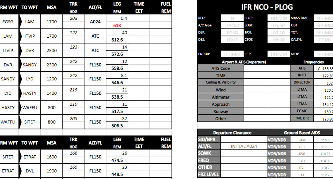
In the UK/European GA (especially for IFR), it’s often a printed A4/A5 form clipped to a kneeboard or flightboard like the Pooleys Control Board (CB-DS), adapted from instructor templates or Excel sheets for redundancy.I still use a customised PLOG in my single-pilot IFR planning despite modern EFBs (SkyDemon, ForeFlight), Autorouter, and avionics, because it provides a reliable, non-electronic backup:
- Completely independent of battery/power/GPS/electrical failures, critical data stays accessible.
- Enforces disciplined, structured pre-flight organisation for longer cross-country legs.
- Supports in-flight progress monitoring (ticking off legs, fuel checks, quick diversion decisions).
- Aids post-flight review, logbook/technical log entries (block/air times), and re-running flights (e.g., IR skill test debriefs or lessons learned).
As described in my “Implementing SOPs” post, I adapted an instructor-designed Excel template to fit my Pooleys Control Board for a “less paper cockpit”:
Structure and sections:
- Bottom A4 NCO OPS flight log: Waypoints, MSA, TRK/HDG, ALT/FL, LEG REM, TIME EET, FUEL REM, positioned for quick in-flight reference or during electrical/GPS issues.
- A5 departure sheet: Timings, airport/ATIS info (frequencies), ATC clearance (SID, initial level, squawk, departure frequency), taxi instructions (especially at bigger airports), freezing levels, and an expanded notes section (including TZDE stable criteria: TZDE +1000 ft for stable configuration, TZDE +500 ft for specific criteria, weather-dependent).
- A5 arrival sheet: Route, enroute alternates, weather for quick decisions, fuel/oxygen checks, carbon copy or duplicate for longer flights with many waypoints.
- Third A5 sheet (enroute alternates + monitoring): Dedicated to 3–5 enroute alternates (ICAO codes, distances/bearings from route, diversion times/fuel needed, approach types, fuel availability, weather notes); fuel burn monitoring table (waypoint/time, fuel used this leg, cumulative, remaining, variance); oxygen system details (tank capacity, initial quantity, flow rates, estimated duration at cruise altitude with margin, switching/check procedures, hypoxia notes).
- For reference, and when inputting data into the GTNs, I have additional printing space for the middle section to include the ATC flight plan route and any NOTAMS of important information that I will need for the flight to complement the flight log.
How I use it:
- Pre-flight: After Autorouter route validation, fill in waypoints, estimated times/fuel, personal minima, NOTAM highlights, and contingencies; clip A5 sheets to the flightboard with laminated approach charts.
- In-flight: Update actual times/fuel burn at checkpoints or waypoints; monitor track against SkyDemon’s magenta line; refer to the third sheet for live enroute alternate reassessment (using Golze weather overlays) and fuel/oxygen checks (e.g., every 30–60 min or at key points).
- Post-flight: Use for accurate logbook/technical log entries and flight review.
The PLOG complements electronic tools (Autorouter for routing/filing/CTOT monitoring, SkyDemon for moving map/traffic/weather) without replacing them, it remains my low-tech safety net for critical data in high-workload or failure scenarios.
Charts
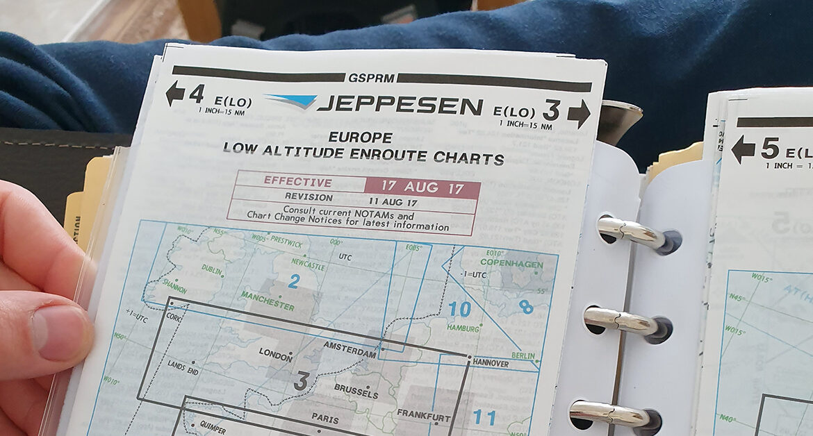
Charts are especially critical for IFR flying because, when you’re buried in clouds, fog, rain, or darkness with zero visual references to the ground or horizon, you can’t fall back on looking out the window like in VFR. Your entire world shrinks to the instruments in the panel, the GPS or navaids feeding data, and, most importantly, the charts themselves. They don’t just show a path; they lay out the entire procedure step by step, define its strict limitations (altitudes, courses, minimums), and, crucially, build and maintain your situational awareness when everything outside is grey or night.
In IFR, charts deliver a precise, standardised structure that keeps you safe, separated from other traffic, and well clear of terrain and obstacles you literally can’t see. Without them, you’re navigating blind in the most unforgiving environment possible.
How charts build that critical situational awareness in IFR
- Mental picture of the invisible – Charts give you a clear “mental model” of where you are relative to terrain, obstacles, airspace boundaries, traffic flows, and the airport environment, even when your eyes tell you nothing. You perceive your position, comprehend how elements interact (e.g., a nearby ridge forcing a higher segment altitude), and project what’s coming next (e.g., anticipate a steep descent or turn on final). This perception-comprehension-projection loop is what keeps you ahead of the aeroplane instead of reacting to surprises.
- Terrain and obstacle avoidance – Enroute charts show Minimum Enroute Altitudes (MEAs), Off-Route Obstruction Clearance Altitudes (OROCAs), and Maximum Elevation Figures (MEFs) that guarantee clearance over uncharted features. Approach plates detail protected segments with step-down fixes and minimum altitudes designed under strict criteria (like TERPS) to keep you above rocks, towers, or buildings, even in zero visibility. Flying below those published numbers without seeing the ground is a fast track to CFIT (Controlled Flight Into Terrain), one of the biggest IFR killers.
- Procedure layout and limitations – Every chart spells out exactly what the approach/departure requires: inbound courses, fix identifications, descent profiles, speed restrictions, required equipment, and decision altitudes (DA) or minimum descent altitudes (MDA). It forces you to brief and understand the “what if” (missed approach path, holding instructions, climb gradients). This prevents guessing or improvising when workload peaks and visibility drops.
- Traffic separation and flow – Charts show how your procedure fits into the bigger picture, STARs sequence arrivals efficiently, SIDs protect departures from obstacles and route you away from conflicts. Knowing the published path means ATC can issue short clearances (“Cleared ILS 27”), everyone flies the same plan, and separation is built in without constant vectors.
- Extra layers for awareness – Beyond the core procedure, charts include airport sketches, nearby navaids, water features, obstructions, and notes on non-standard items (like cold-temperature corrections or inoperative components). These boost overall awareness, e.g., spotting a better runway option or understanding why the missed approach turns a certain way.
Modern EFB apps (ForeFlight, SkyDemon, etc.) make this even more powerful with moving maps, geo-referenced overlays, and synthetic vision that show terrain rising toward you, but they all pull from the same official chart data. The chart is still the foundation: it’s what you brief, what you cross-check against your instruments, and what saves you when the electronics glitch or the weather surprises you. In the end, for IFR, charts aren’t optional reference material, they’re your eyes when the real ones fail. They turn “flying blind” into flying informed, structured, and, above all, aware. Skip or misread them, and the difference between a smooth approach and a very bad day gets razor-thin.
Where to access them
Here is a list of the main chart providers commonly used by general aviation (GA) pilots for real-world IFR flying (with a focus on Europe, as of March 2026). These are the most practical and widely adopted options for enroute, terminal procedures (SIDs/STARs/approaches), airport diagrams, and AIP integration in single-pilot or light GA cockpits.
- ForeFlight Europe – The leading all-in-one EFB for European IFR GA pilots. It includes Eurocontrol-sourced IFR enroute charts (high/low), georeferenced procedure charts (SIDs/STARs/approaches), airport diagrams, and full AIP documents. Jeppesen add-ons provide even more detailed, standardised worldwide IFR charts (enroute, terminal, airport) overlaid on the moving map with ownship position. Excellent dynamic weather/NOTAM layers, frequent updates, and strong integration for real-time IFR ops.
- Jeppesen – The industry benchmark for accuracy and consistency. Jeppesen digital charts (Airway Manual style) cover worldwide IFR enroute (low/high), terminal procedures, airport diagrams, and supplements; available via ForeFlight add-on, Jeppesen Mobile FliteDeck, or standalone subscriptions. Trusted by pros and many GA pilots for standardised presentation across Europe and beyond, with frequent revisions.
- SkyDemon – Europe’s most popular GA-focused EFB, strong for practical IFR in busy airspace. It offers airways mode (cleans up VFR clutter for IFR enroute focus), georeferenced approach plates overlaid on the map, AIP-integrated charts, and NOTAM/weather bulletins. Excellent for hybrid VFR/IFR touring and intuitive cockpit workflow, though IFR enroute/procedure depth is not as comprehensive as ForeFlight/Jeppesen for pure instrument work.
- Navigraph Charts – Jeppesen-sourced digital IFR charts (enroute, terminal, airport) with worldwide coverage. Popular among GA pilots (especially those who sim) for realistic, high-fidelity maps and procedures; works well as a standalone or companion tool.
- Garmin Pilot – Garmin’s EFB with integrated charts (Jeppesen-style enroute/terminal in some regions). Good for pilots with Garmin avionics; solid European support, but less dominant in pure GA IFR compared to ForeFlight/SkyDemon.
- Official AIP sources (via EUROCONTROL EAD Basic or national AIS) – Free/low-cost official charts (e.g., ERC enroute, AD airport diagrams, procedure plates from national providers like DFS Germany, ENAIRE Spain). Essential for regulatory compliance and backups, though less dynamic/user-friendly than EFB apps.
For most European real-world single-pilot IFR in light GA (cross-border, low-level airways, procedures), ForeFlight Europe (often with Jeppesen add-ons) is frequently regarded as the top choice for comprehensive, integrated IFR charting in 2026, especially for dynamic overlays and procedure support. SkyDemon remains unbeatable for intuitive European-specific handling and cost-effectiveness if your flying mixes VFR/IFR. Try both (ForeFlight has a trial; SkyDemon offers 30 days free) to match your cockpit setup. Always cross-check with official AIP sources (EAD) for the latest regulatory data. Safe flying!
Flight plan filing and management
In modern day (as of March 2026), single-pilot IFR pilots in Europe file ICAO flight plans primarily online through dedicated GA-friendly tools that connect directly to Eurocontrol’s IFPS (Integrated Initial Flight Plan Processing System) for validation, distribution to ATC units, and CTOT issuance.
The most popular and efficient methods for light GA IFR are:
- Autorouter. aero – Widely considered the best for European single-pilot IFR GA. You plan the route (it auto-generates valid airways/SIDs/STARs, checks for slots, previews CTOT risks), then file directly to IFPS with one click. It provides instant validation feedback, handles GCR for airport slots, monitors CTOTs (alerts via email/SMS/Telegram bot), and supports easy amendments (CHG/DLA) or cancellations (CNL). Export routes to SkyDemon or other EFBs for in-flight use. Free basic tier covers most needs; premium adds extras.
- ForeFlight Europe – Excellent for integrated planning and filing. Configure your aircraft with ICAO codes (equipment, surveillance, wake category), generate Eurocontrol-validated routes (recommended or manual), and file VFR/IFR plans directly via its connection to the global network (including IFPS for Europe). It handles filing confirmations, amendments, and monitoring; strong for pilots wanting charts/procedures in the same app.
Other options include EuroFPL (eurofpl.eu) – a dedicated European filing service with route catalogues, validation, and management; or Garmin Pilot for Garmin avionics users (solid filing and chart integration).
General tips:
- File at least 3 hours before EOBT (up to 120 hours ahead for GA); Autorouter often files in seconds with guaranteed ACK.
- Use Item 18 for GA specifics (REG/, RALT/, TALT/, PBN/ codes, etc.).
- Monitor via tool alerts for CTOTs/changes; amend as needed.
- For emergencies or last-minute, call ATC or use handler/ARO if online filing isn’t possible.
For most solo European IFR pilots in light GA, Autorouter remains the go-to for fast, accurate filing and management, often paired with SkyDemon or ForeFlight for charting and in-flight use. Always cross-check with current AIP/NOTAMs and your aircraft setup.
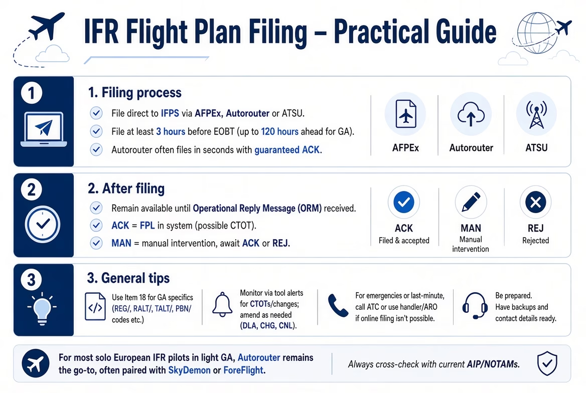
AFPEX
NATS AFPEx (Assisted Flight Plan Exchange) is the official UK-based online system provided by NATS (National Air Traffic Services) that allows pilots, airfields, and operators to file ICAO flight plans and related messages directly over the Aeronautical Fixed Telecommunication Network (AFTN) from a desktop PC.
It’s particularly useful for UK-based GA pilots (including those flying IFR in Europe) because it’s free to register for individual use, provides a direct connection to the AFTN (the same network airlines and ATC use), and handles validation, distribution to relevant units (including Eurocontrol IFPS for European flights), and basic messaging like delays or cancellations. Historically introduced after UK airfield reporting offices closed, it remains a reliable, low-cost option for filing without relying on third-party apps that might charge credits or subscriptions.
In practice, you’ll need a Windows or Linux laptop/desktop (or a Mac with tweaks) to access the interface, draft/submit plans, monitor messages (ACK/REJ, CTOTs), and send amendments. It’s a free, direct AFTN tool once registered, but its dated Java nature makes it less convenient than modern EFB filers like Autorouter or ForeFlight for mobile/on-the-go use.
How to access and use AFPEx in 2026
- Registration – UK-licensed pilots can apply for an individual account via the NATS forms portal (https://forms.nats.aero/). Fill in your details (name, licence number, aircraft reg, email, etc.), submit, and wait for approval (usually a few days; it includes security checks and assignment of a user ID, password, and passphrase).
- Login/launch – Once approved, go to https://www.flightplanningonline.co.uk/ (the main AFPEx portal), log in with your credentials, and download/run the Java-based application (centre.cadas file). It works on Windows and Linux (some Mac users run it via compatibility layers or virtual machines).
- Filing a plan – Open the FPL template; it auto-fills your originator address and some defaults. Enter your ICAO flight plan details (Items 7–18 as standard), including GA-specific fields like REG/ in Item 18. AFPEx assists with addressing (routes to correct FIRs/ACCs), preferential UK routes for IFR, and IFPS validation. Submit, and you get immediate feedback (ACK/REJ) plus pending messages for confirmations or errors.
- Management – Monitor pending messages for replies (e.g., CTOTs from Eurocontrol), send amendments (CHG/DLA), cancellations (CNL), or other AFTN messages (e.g., DEP/ARR). It supports preferential UK IFR routing and acts as a backup to modern EFB filers.
- Help/support -24-hour helpdesk (phone/email via NATS site); guides available on nats.aero/do-it-online/afpex-guide.
Pros for single-pilot GA IFR
- Free for registered UK pilots (no per-plan credits like some apps).
- Direct AFTN access with no middleman delays.
- Reliable for UK/Europe flights (handles IFPS zone validation well).
- Good for backup if your main tool (Autorouter, ForeFlight) has issues.
Cons
- Older Java-based interface (not as slick as modern EFBs like Autorouter or ForeFlight).
- Requires registration/approval (not instant).
- Less automated route generation/CTOT monitoring compared to Autorouter.
- Primarily UK-focused (though works for international flights).
Many UK GA pilots still use AFPEx as a free, official backup or for simple UK domestic flights, while relying on Autorouter for advanced European IFR routing and CTOT handling. If you’re UK-based and want a no-cost option alongside your main planner, it’s worth registering. Check nats.aero/do-it-online/assisted-flight-plan-exchange-afpex for the latest access info.
CFMU & Flow Restrictions
The CFMU Portal refers to the legacy online interface of EUROCONTROL’s Central Flow Management Unit (CFMU), which was the former name for the organisation now known as the Network Manager (NM). The CFMU Portal has been replaced by the modern Network Operations Portal (NOP), which serves as the primary gateway for interacting with EUROCONTROL’s Network Manager Operations Centre (NMOC). The NOP provides real-time visibility into the European ATM network situation, including flight plan status, ATFCM measures, CTOTs (Calculated Take-Off Times), airspace restrictions, and more.
There are two versions:
- Public NOP – Freely accessible to everyone (no login required) at https://www.public.nm.eurocontrol.int/PUBPORTAL/gateway/spec/index.html. It offers general network overviews, ATFCM Daily Plans (ADP), Initial Network Plans (INP), delay statistics, and basic tools like the Route Availability Document (RAD) viewer.
- Protected NOP – Restricted access for operational stakeholders actively engaged in ATFM (Air Traffic Flow Management), airline/airport operations, or related support services. It includes advanced features like detailed flight queries, measure coordination (e.g., slot extensions/improvements), traffic counts, airspace data, and direct interaction with NMOC tools (e.g., CHMI for aircraft operators or flow positions).
Access for pilots/aircraft operators (especially GA). Individual pilots or small GA aircraft operators do not typically qualify for protected NOP access, as it is restricted to organisations (airlines, ANSPs, airports, handlers, or FMPs) that sign a formal NM service agreement and meet eligibility criteria (e.g., actively involved in ATFCM or large-scale ops).
To request access to the protected NOP:
- Fill out the service request form on the EUROCONTROL website (linked from https://www.eurocontrol.int/portal/network-operations-portal or the NM access page). This determines your eligibility and required profile (e.g., aircraft operator/CIAO role).
- If approved, your organisation must sign an official NM agreement (terms and conditions for data use and security).
- Access is then granted via username/password (often with an RSA SecurID token for authentication), and features are customised based on your role (e.g., limited flight query access for operators).
For most individual GA pilots or small operators:
- Public NOP is sufficient for situational awareness (e.g., checking regulations, delays, or network status).
- Use GA-focused tools like Autorouter.aero for flight plan filing, CTOT monitoring, and slot requests (GCR) – these connect to IFPS/NMOC without needing NOP login.
- For urgent operational queries (e.g., flight-specific CTOT issues), contact NMOC directly via phone/email (details at https://www.eurocontrol.int/contact/network-management-contacts) or use your filing tool’s support.
Individual aircraft owners/operators (including private GA pilots operating their own aircraft) can apply for protected access to the EUROCONTROL Network Operations Portal (NOP) as an Aircraft Operator (AO) profile, even without being part of a larger airline or organisation.
Why does this work for private owners?
- Approval is not automatic – it depends on your explanation and verification.
- For most solo GA IFR pilots, the public NOP (no login) + tools like Autorouter (which handles IFPS filing/CTOT monitoring without NOP login) are sufficient for day-to-day ops.
- Protected access is more valuable if you fly frequently in regulated airspace, deal with frequent CTOTs/delays, or want direct interaction with NMOC for complex flights.
If you’ve already applied and gained access as the operator of your aircraft, that’s consistent with the non-AOC process, congrats! Use it for enhanced flight monitoring and coordination. For any issues, contact NM support via the portal or Eurocontrol.int contacts.
Weather
Weather is a huge aspect of IFR flight planning. Since it involves many variables, wind, visibility, turbulence, icing, cumulonimbus clouds, fronts, and more. It demands multiple reliable tools and sources to build a complete, current picture before departure and during the flight. That’s why I’ve written a detailed, dedicated section covering essential weather resources, graphical chart links, and practical tips tailored for European IFR pilots to support safer go/no-go decisions and reduce risks from poor planning or outdated data.

Conclusion & Resources
This isn’t teaching you to suck eggs; your IR theoretical knowledge (TK) already gave you the core foundation: understanding charts, procedures, meteorology, navigation, regulations, and the principles behind IFR operations. This guide builds on that TK with the practical, real-world tools I’ve gathered from years of flying almost everywhere in Europe and always pushing to explore further.
It starts with the personal spark of “I’d love to be there”. The quiet drive that turns theory into actual trips, then layers on the essentials: EuroGA’s detailed airport reports for accurate fees, handling quirks, and fresh pilot experiences, the Network Operations Portal (NOP) for spotting restrictions and CTOTs, and terminal procedure charts (SIDs, STARs, IAPs) that aid vital situational awareness when you’re flying blind in IMC.
Tie it together with thorough briefings, current weather and NOTAM checks, EuroGA forums for the latest gotchas, early filing through validated tools, and well-chosen alternates. Europe’s skies reward smart preparation and curiosity. Safe, enjoyable IFR flying isn’t about memorising more rules, it’s about turning solid TK into flexible, informed decisions that keep every trip safe, efficient, and worth the adventure.
My IFR Flight Planning Checklist
This content is currently under development.
Airports – The Airport directory
Airports (by developer Peter Lundkvist, often referred to as “The airport directory” in pilot circles) is a lightweight, dedicated airport directory app optimised for iPad (and iPhone) use in general aviation flight bags. It’s a one-time purchase ($8.99 as of early 2026) and covers over 27,000 airports worldwide, making it a solid companion for quick lookups without the overhead of a full EFB like ForeFlight or SkyDemon.Key Features for Pilots
- Fast search by city, airport name, ICAO, IATA, or local ID.
- Pulls live METAR, TAF, NOTAM, and SNOWTAM reports directly.
- Favourites list for your go-to or frequently visited fields.
- Personal notes section – add your own observations, handling tips, fees from past visits, or quirks (great for building your own “EuroGA-style” log over time).
- Tools section for quick conversions or calculations.
- Universal app: buy once, works across iOS devices (optimised for iPad’s larger screen).
It’s not as feature-heavy as integrated EFBs (no moving maps, routing, or charts), but excels as a fast, offline-capable reference for airport basics + current weather/NOTAMs. Many GA pilots use it alongside SkyDemon or ForeFlight for airport-specific deep dives, especially when checking trends in METARs or adding personal notes after a visit.
Download it from the App Store: search “Airports” by Peter Lundkvist (App ID 299117180) or visit apps.apple.com/app/airports/id299117180.
From my European touring experience, it’s handy for those “quick confirm the latest METAR/TAF and jot a note” moments before filing, keeps things simple and reliable without subscription bloat. If you’re after something even more stripped-down, check alternatives like Airports Pro or Airports 4 Pilots, but this classic one holds up well for pure directory + weather pull needs.
Disclaimer: This guide is not an instruction or official documentation. It’s purely a personal reference point, drawing on publicly available information and common practices. Always consult a qualified flight instructor, your aircraft’s documentation, current regulations (e.g. UK CAA, EASA, Eurocontrol), and official sources for guidance appropriate to your experience, aircraft, and intended flight. Do not rely on this guide for operational decisions.
Version 1.0 – Last Updated 22/11/2026
Supporting the YouTube Channel –

Support the YouTube Channel –
Welcome to The FLYING VLOG…
I am a current PPL(A), SEP (LAND), IR(A) SE/SP PBN, IR(R) & Night holder. Flying the world, exploring its hidden treasures. Taking pictures and vlogging the journey; I hope I can provide you with an oversight of my progression as I develop my skillset and airmanship in exclusive videos on my YouTube channel.
Now flying IFR in the Airways of Europe & beyond. Bringing you an exclusive niche to YouTube, flying in the same skies with commercial airliners.